
INSIGHT
Three emerging LiDAR applications for rail data capture
Connect with us
Across the U.S. and around the world, regulations and the technology age are driving companies to consider new solutions and explore different options for how to capture, process and store data about their operations. The rail industry has felt the effects of this trend in the form of positive train control regulations and the need for enterprise or system-wide data. Light detection and ranging technology, commonly referred to as LiDAR, has quickly emerged as a possible way to capture track information—and in some applications without the need to interrupt or affect daily train operations.
"LiDAR equipment quickly captures very detailed data by using the reflection time of rapid pulses of laser light to map a surface. This information is used to compute ranges, or distances, to objects," explained Doug Morrison, rail services director at Bartlett & West. "The newest trend is exploring different applications and uses of LiDAR technology and considering how to apply them within the rail industry."
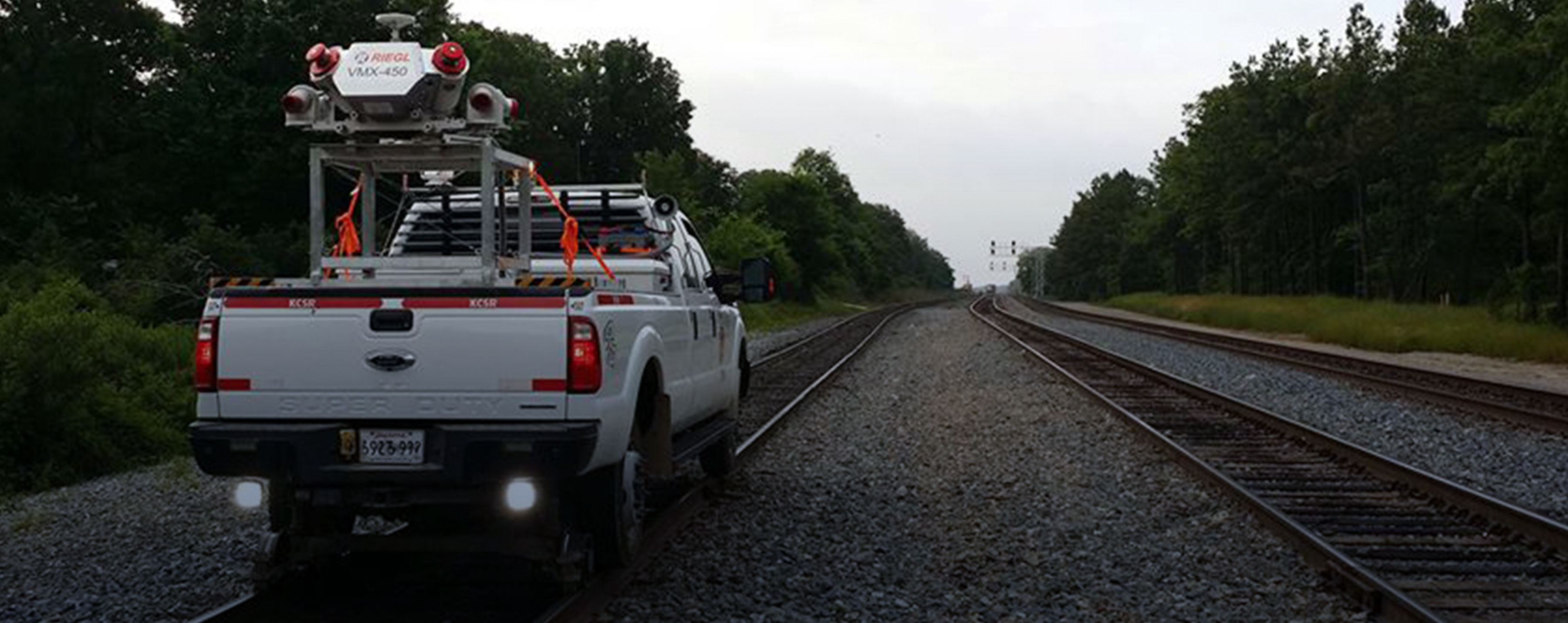
Mobile LiDAR
LiDAR data is collected from one of three equipment platform types—ground-based stationary, mobile, or aerial. Whereas ground-based, terrestrial LiDAR systems are ideal for close-range applications, mobile LiDAR scanners offer extremely high measurement rates and provide dense, accurate and feature-rich data at driving speeds. Mobile LiDAR is therefore perfect for mapping rail corridors, with capability to provide measurements at a rate of up to 1.1 million per second. The mobile LiDAR equipment can be mounted to a vehicle or train locomotive to run on and map the track and surrounding area. The downside is that vehicle-based set-ups create the need to interrupt regular track operations.
Drone Scanning
Other applications are looking to the sky in an effort to capture corridor information. For example, Riegl’s RiCOPTER is an unmanned aerial vehicle, also known as a drone, which is equipped to integrate with the Riegl VUX LiDAR sensor, which can measure a 330-degree field of view at 500,000 measurements per second. Drone LiDAR scanning solutions are another option for track corridor mapping and don’t need to effect train operations. However, their biggest limitations are the maximum flight time of any particular drone unit. The RiCOPTER has a maximum flight of 30 minutes at one time.
CIM Car
Another custom, LiDAR-based platform is one that was created through a joint effort of RJ Corman and Bartlett & West. These companies came together to develop what they call a CIM (corridor information modeling) Car. This proprietary solution incorporates 360-degree LiDAR technology, an independent power supply, and an on-board data center all within a typical rail car—thereby allowing the equipment to run in revenue and safely collect change detection and rail corridor data without interrupting operations. The CIM car's LiDAR technology can capture up to 500,000 measurements per second.
Railroad are feeling the need to collect and populate data into an enterprise platform, and these LiDAR applications are striving to meet that need. As Morrison stated of the CIM Car, "Finding track time for data collection without impeding operation is challenging. With the new regulations requiring that field assets continuously be validated and verified, it is critical that solutions like the CIM Car are explored and available. Data captured through this technology satisfies multiple historical issues—such as high-wide clearance detection, vegetation and encroachment detection, and utility crossings—all in a single pass."
Thanks to the firm's rail and technology expertise, Bartlett & West's clients have access to:
- LiDAR solutions to acquire precise data points and GPS coordinates for clearance requirements—plus exact visualization of tracks and corridors.
- Mobile and custom CIM Car LiDAR set-ups to improve safety and reduce the need for human intervention during corridor mapping, thereby also reducing overhead costs.
- High-speed data collection with minimal to no interruptions to regular operations.
Tell us about your project
We’d love to work with you. Tell us the services you are seeking and one of our team members will connect with you.