Project Detail
Southwest Water Authority GIS Services
Challenge
Bartlett & West has been providing consulting services to the North Dakota State Water Commission (NDSWC) since 1981 and to the Southwest Water Authority (SWA) since 1991. The NDSWC owns and constructs the Southwest Pipeline Project (SWPP).
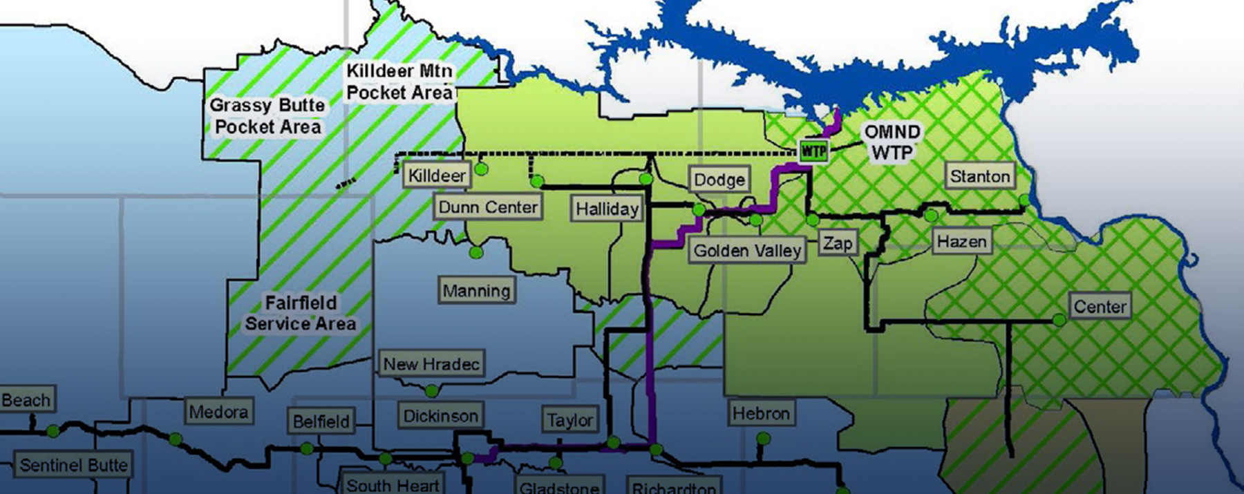
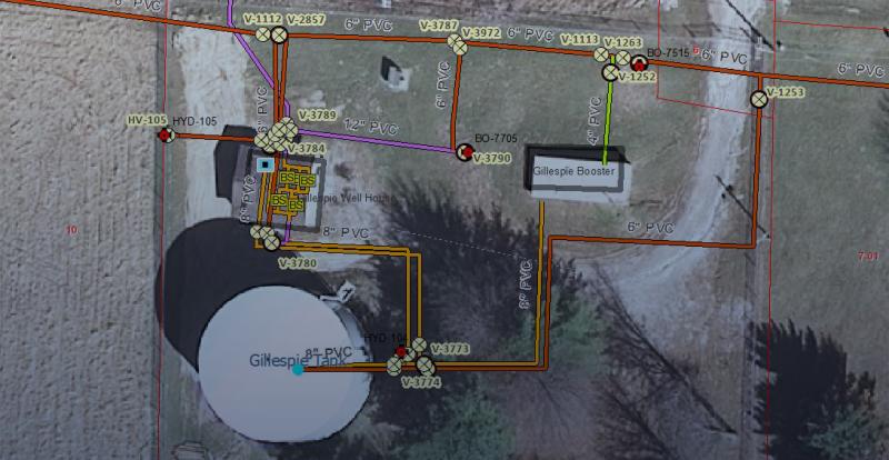
The SWA is charged with operations, maintenance, and replacement duties on the SWPP, a large regional water system located in southwest North Dakota. It consists of more than 5,000 rural customers across 26 communities, with 4,500 miles of rural pipeline. As part of the consulting services, Bartlett & West created and manages a functioning GIS project for the SWA. The base datasets for the system’s pipeline routes and facilities were created by using data collected via GPS survey-grade techniques.
The GPS data was collected by three independent sources—Bartlett & West, Southwest Water Authority and an additional vendor, each with different collection procedures. The client wanted a single source for GPS data collection.
Solution
Bartlett & West’s method of collecting and processing data was chosen as the preferred method over the other vendor’s method. Bartlett & West gathered all GPS data for the various sources and adjusted the data to match a common data structure. Bartlett & West then created an ESRI-based GIS project that included many customized tools to manage and display the GIS datasets.
Value
All GPS field data is currently being collected by Bartlett & West and used to update the SWA’s GIS project. The collected GPS data is also being used to analyze final construction material quantities as well as being used as base layers to create record drawings in AutoCAD.
Related Projects

Tell us about your project
We’d love to work with you. Tell us the services you are seeking and one of our team members will connect with you.