Project Detail
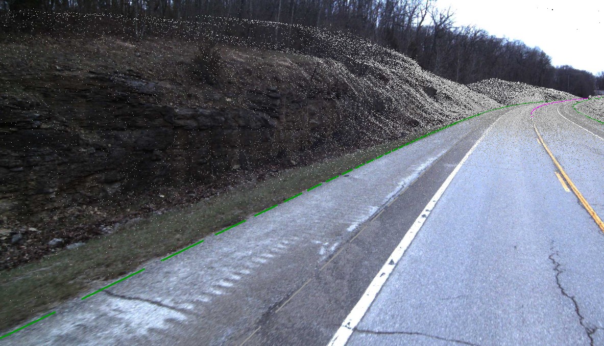
LiDAR for safer, faster mapping
Challenge
Missouri Department of Transportation (MoDOT) needs a reliable, consistent and flexible way to collect roadway data. The annual program helps MoDOT map upcoming infrastructure projects.
Solution
Since 2014, Bartlett & West has partnered with MoDOT for the annual statewide survey, which uses mobile and aerial Light Detection and Ranging (LiDAR) technology. Bartlett & West processes the data sets to extract and classify topographic features and create a basemap with contours. Field notes, text files and the survey report are added to geopak files and delivered to MoDOT designers in order of priority. Aerial survey partner Surveying and Mapping (SAM) expands the team’s flexibility to respond to the unique requirements of each individual project.
For instance, of the five LiDAR survey projects planned for 2020, one uses only mobile LiDAR due to flight restrictions caused by close proximity to the airport in St. Louis, Missouri. Another project uses only aerial survey because it is a 10-mile rural corridor. The three remaining projects take a hybrid approach for a mix of urban corridors and a rural interstate corridor stretching 23 miles. Conventional topographic survey helps round out a complete data set that is as accurate as possible.
Value
In the 2019 MoDOT survey program, Bartlett & West combined aerial and mobile LiDAR data into one hybrid survey deliverable for the first time. That program, which earned an ACEC Missouri Grand Award for Engineering Excellence, totaled 182 miles of roadway and 11,000 acres.
Related Projects


Tell us about your project
We’d love to work with you. Tell us the services you are seeking and one of our team members will connect with you.